 geographical data management software / calculation / quality / embedded
GeoGis
Vnation JSC
-
Function:
geographical data management, calculation, quality, embedded, mapping, data collection
-
Operating system:
Windows
Stonex GeoGis is a powerful yet simple software solution for the collection of high quality feature and position data for GIS update and maintenance. GeoGis software provides simple and efficient workflows to capture high quality data quickly and easily. GeoGis is an option that can be embedded into handheld GIS systems.
Description
GeoGis software consists of two integrated modules: GeoGis Mobile for the field work and GeoGis Office for desktop elaboration. With GeoGis you never have to worry about which application to use to manage and transfer your data. With GeoGis software the workflow is straight and simple, from the field to the office and vice versa.
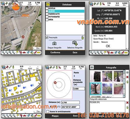
Stonex GeoGis software makes the field data collection fast and easy to do thanks to a full set of field-designed features, such as graphical map display, clear icon toolbar and useful calculation tools. Stonex GeoGis software also makes it easy to incorporate digital photos into the data collection workflow using an handheld with integrated digital camera. Field workers can take and preview photos, attaching them to the features and create complete set of data for many different purposes.
With Stonex GeoGis software you can create custom data attributes and use them to assign values to the assets. Data forms can be pre-compiled basing on previously entered attribute values for maximum data collection efficiency.


